Map of Mariland and Delaware with counties, cities and towns - us
Maps of the United States with counties and cities
Go to content
Map of Mariland and Delaware with counties, cities and towns
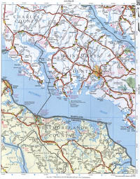
Map of the states of Maryland and Delaware
Detailed map of the states of Maryland and Delaware with counties
Map of the states of Maryland and Delaware with all cities and towns, highways, and dirt roads.
The map of Western Maryland has been placed on a separate page.
×
Map of Mariland and Delaware
Map of Western Mariland
1 Garret County MD and Somerset County PA
2 Allegany County MD and Bedford County PA
3 Allegany County MD and Washington County MD
4 Washington County MD and Franklin County PA
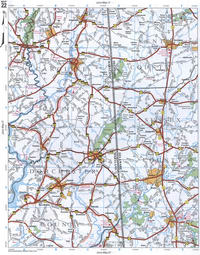
5 Frederick County MD and Carroll County MD
6 Carroll County MD and Baltimore County MD
7 Harford County MD and Cecil County MD
8 Cecil County MD and New Castle County DE
9 Salem County NJ and Delaware County PA
10 Garrett County MD and Grant County WV
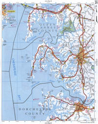
11 Mineral County WV and Hampshire County WV
12 Frederick County VA and Berkeley County WV
13 Washington County MD and Frederick County MD
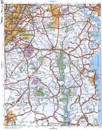
14 Montgomery County MD and Howard County MD
15 Howard County MD and Anne Arundei MD
16 Harford County MD and Kent County MD
17 New Castle County DE and Kent County DE
18 Kent County DE and Cumberland County NJ
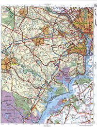
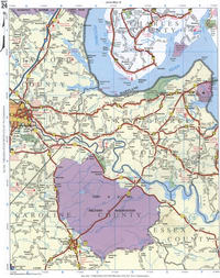
19 Charles County MD and Fairfax County VA
20 Prince Georges County MD and Anne Arundel County MD
21 Queen Annes County MD and Talbot County MD
22 Caroline County MD and Dorchester County MD
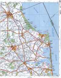
23 Sussex County DE
24 Charles County MD and Stafford County VA
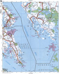
25 Saint Marys County MD and Charles County MD
26 Dorchester County MD and Saint Marys County MD
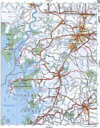
27 Wicomico County MD and Somerset County MD
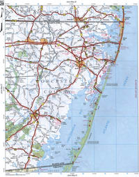
28 Worcester County MD
29 Northumberland County VA and Lancaster County VA
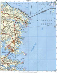
30 Somerset County MD and Accomack County VA
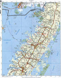
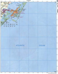
31 Accomack County VA
Back to content
To use this website you must enable JavaScript.