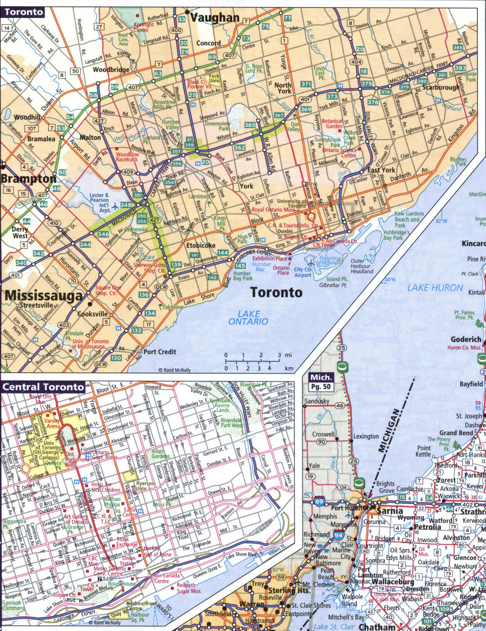
Detailed maps of the cities of Hamilton, Kingston, London, Niagara Falls, Ottawa, Toronto, Windsor
Maps Provinces and cities of Canada > Ontario
Maps major cities in Canadian province of Ontario: Hamilton, Kingston, London, Niagara Falls, Ottawa, Toronto, Windsor
The largest cities of the Canadian province of Ontario: Hamilton, Kingston, London, Niagara Falls, Ottawa, Toronto, Windsor. Maps of the roadways of these cities are shown here. Cities are arranged in alphabetical order.
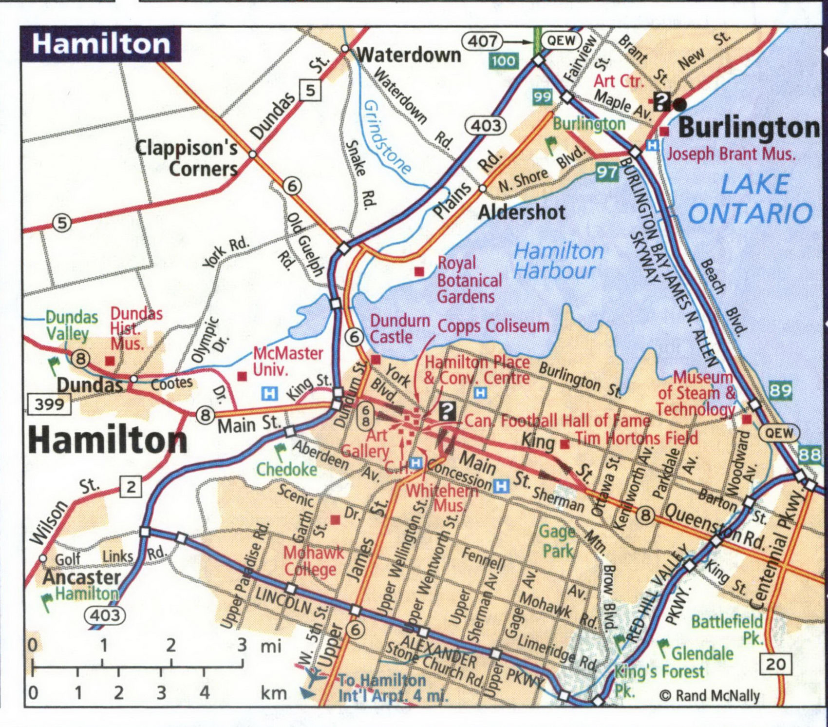
Detailed map of streets and highways of the city of Kingston.
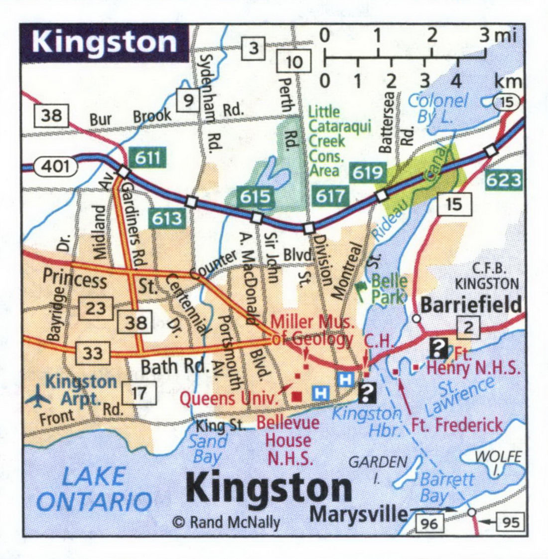
Detailed map of streets and highways of the city of London, Canada.
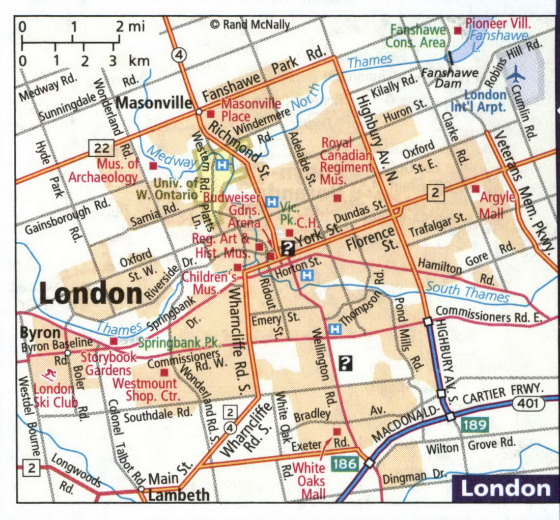
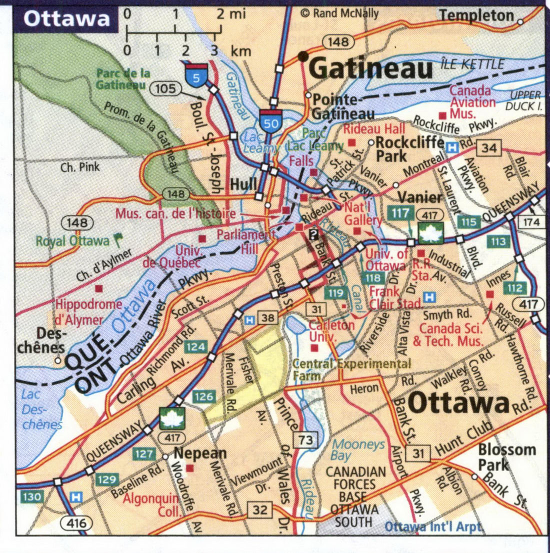
Detailed map of streets and highways of the city of Ottawa.
Detailed map of streets and highways of the city of Toronto.
