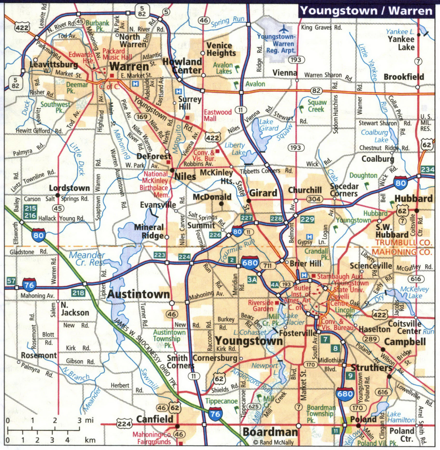
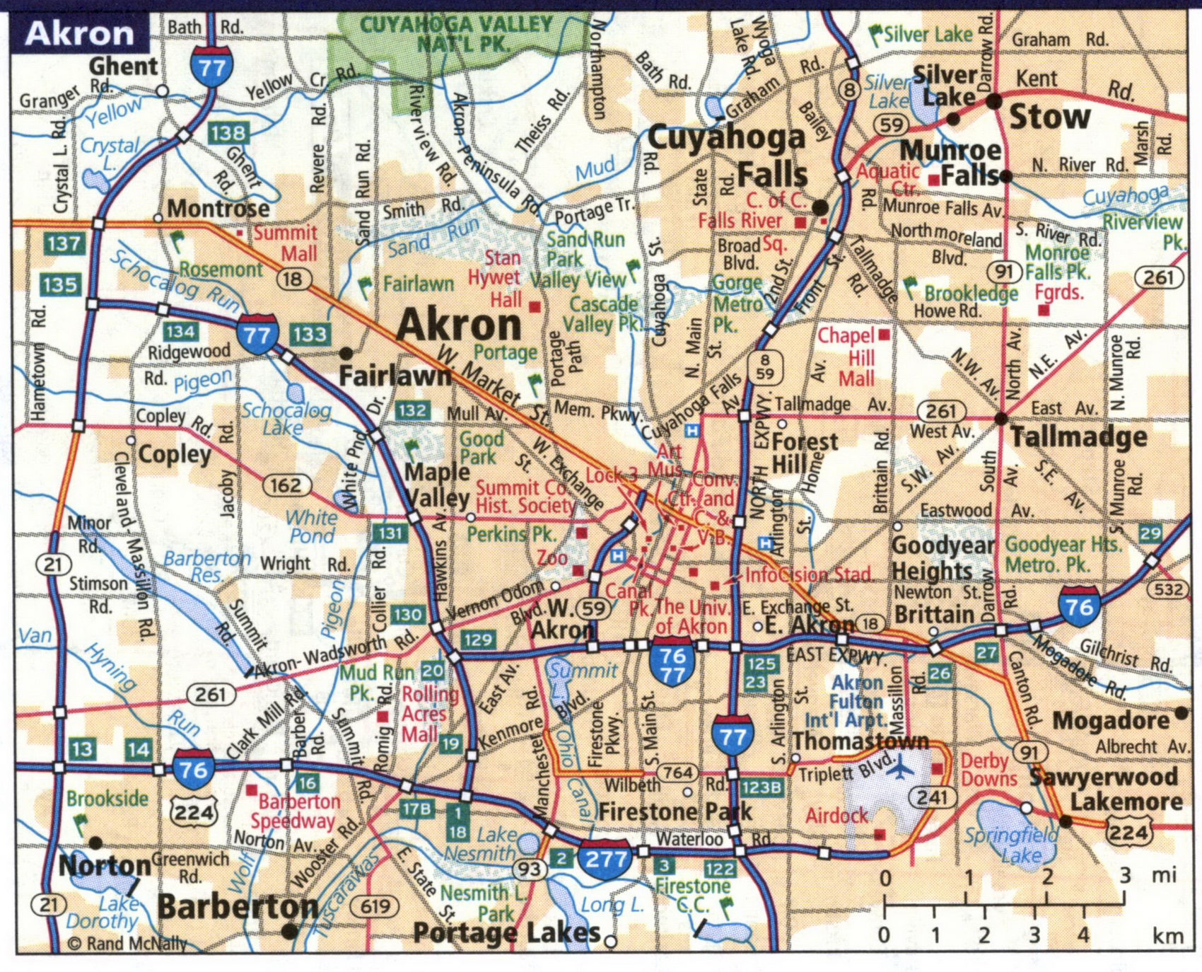
Detailed maps of the cities of Akron, Canton, Cicinnati, Cleveland, Columbus, Dayton, Mansfield, Sandusky, Springfield, Toledo, Warren, Youngstown OH
Maps of all major cities in Ohio: Akron, Canton, Cincinnati, Cleveland, Columbus, Dayton, Mansfield, Sandusky, Springfield, Toledo, Warren, Youngstown OH
Ohio's largest cities are Akron, Canton, Cincinnati, Cleveland, Columbus, Dayton, Mansfield, Sandusky, Springfield, Toledo, Warren, Youngstown OH. Maps of the roadways of these cities are shown here. Cities are arranged in alphabetical order. You can print maps of Ohio cities. All images are printable.
Detailed map of streets and highways of the city of Akron. All images are printable.
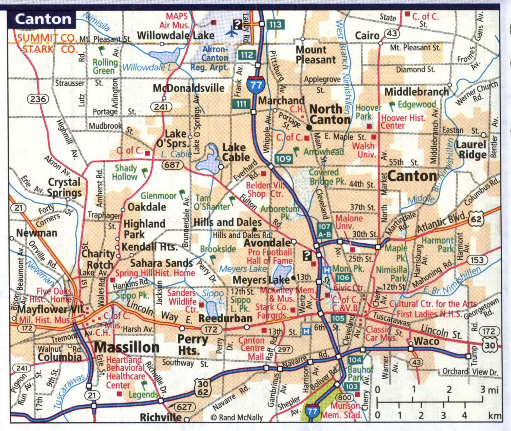
Detailed map of streets and highways of the city of Canton.
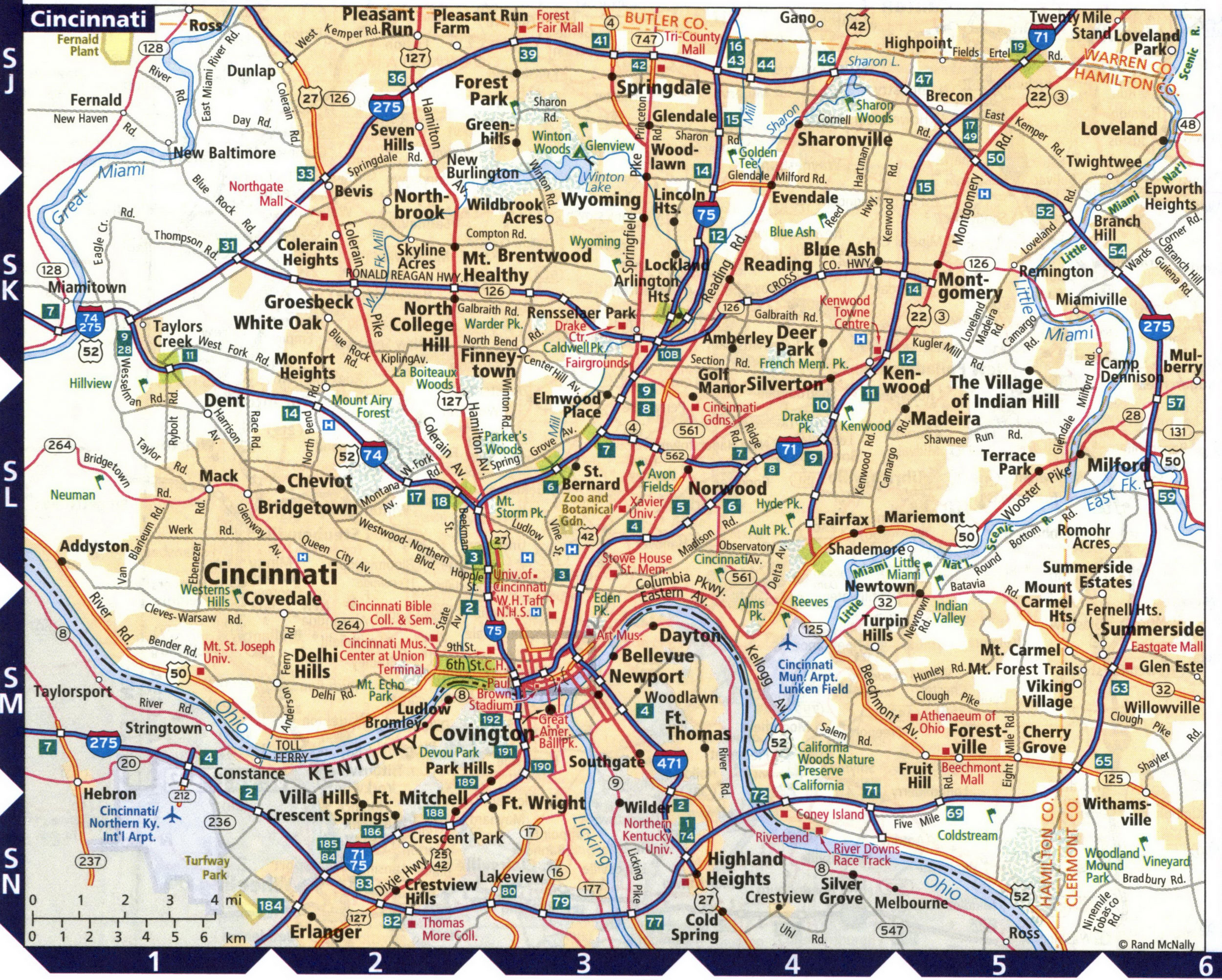
Detailed map of streets and highways of the city of Cincinnati.
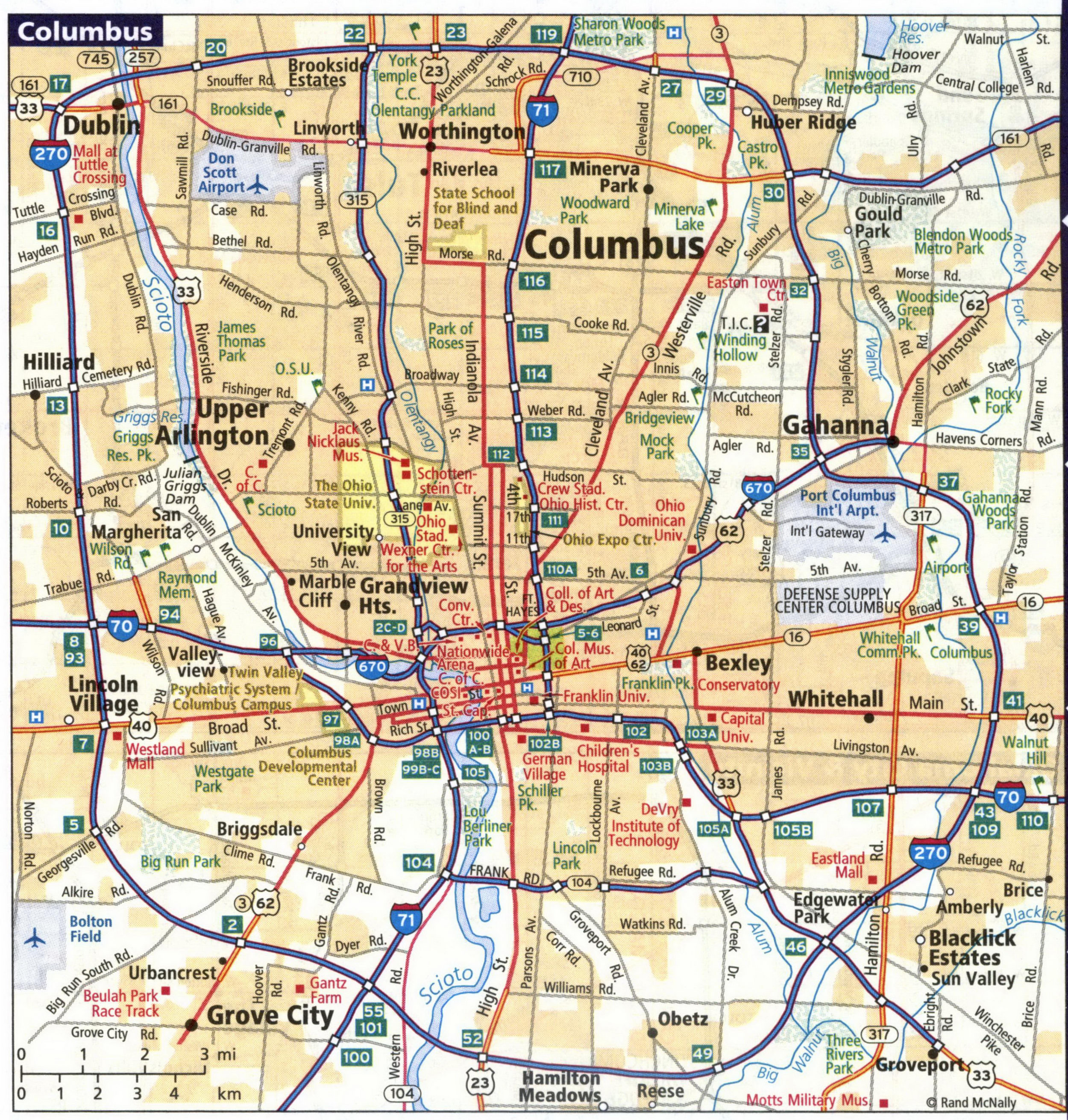
Detailed map of streets and highways of the city of Columbus.
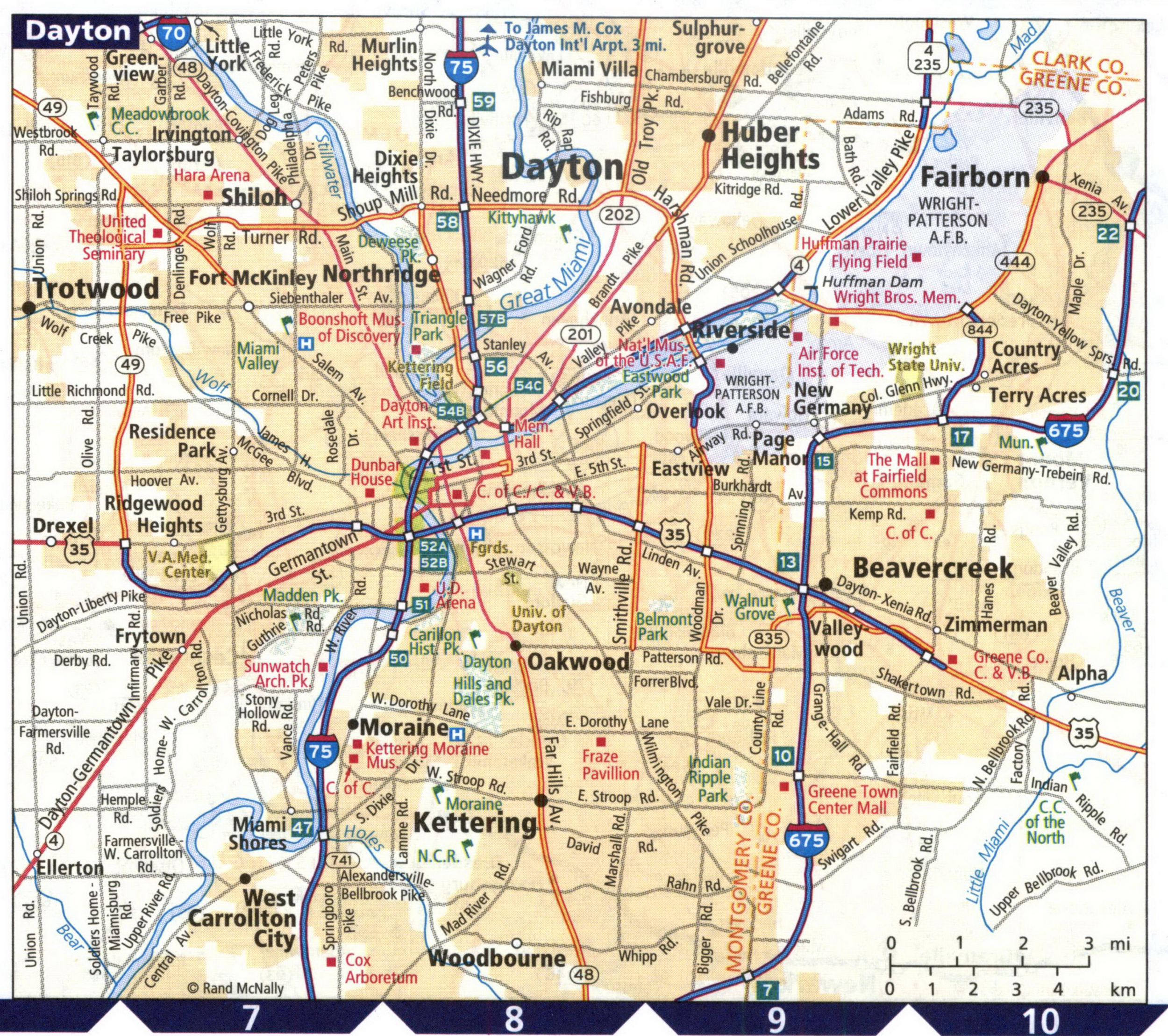
Detailed map of streets and highways of the city of Dayton.
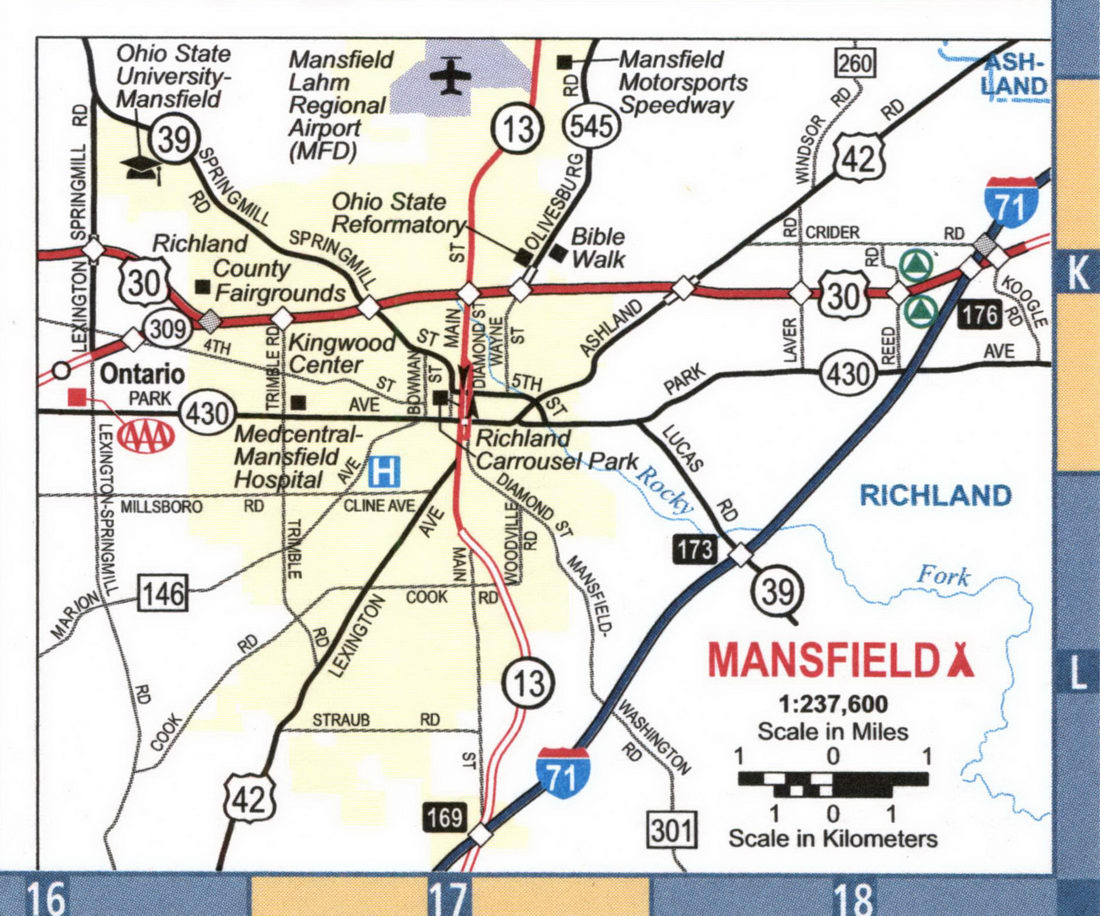
Detailed map of streets and highways of the city of Mansfield.
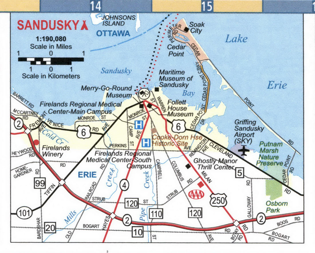
Detailed map of streets and highways of the city of Sandusky.
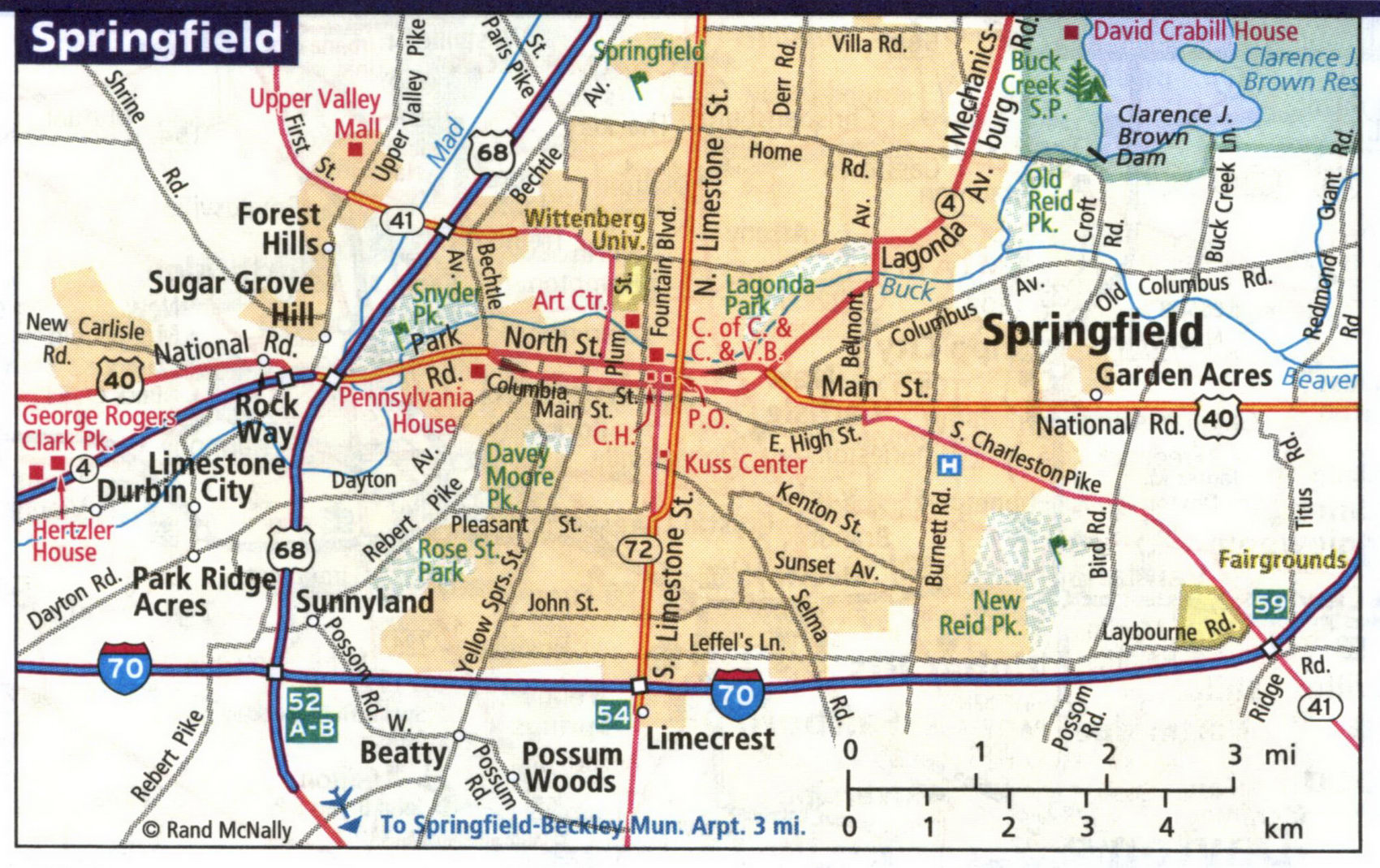
Detailed map of streets and highways of the city of Springfield.
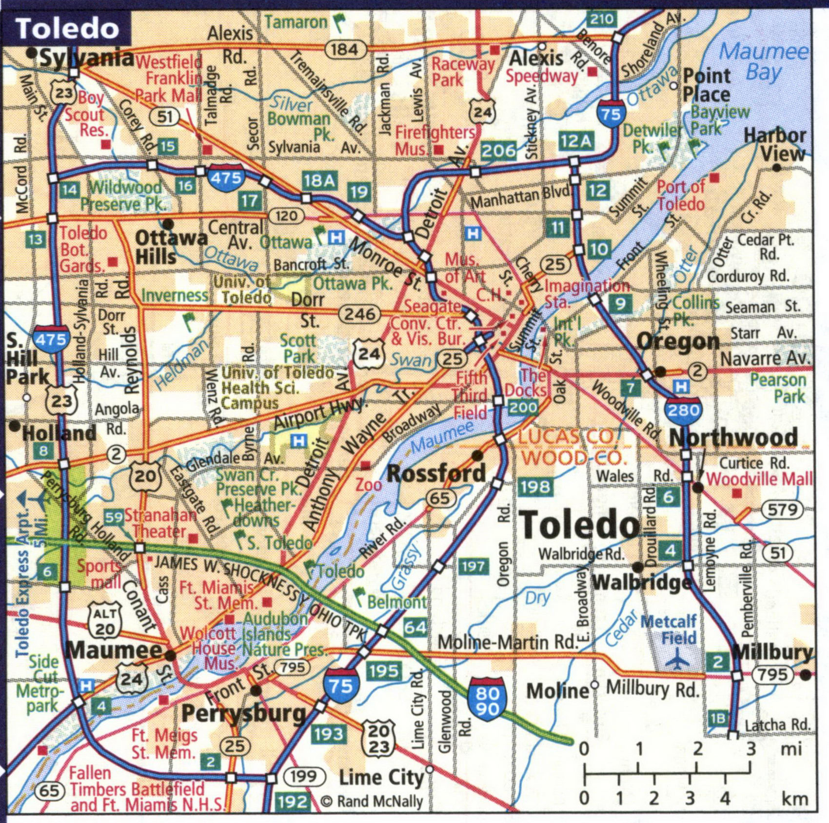
Detailed map of streets and highways of the city of Toledo.
Detailed map of streets and highways of the city of Warren and Youngstown.
