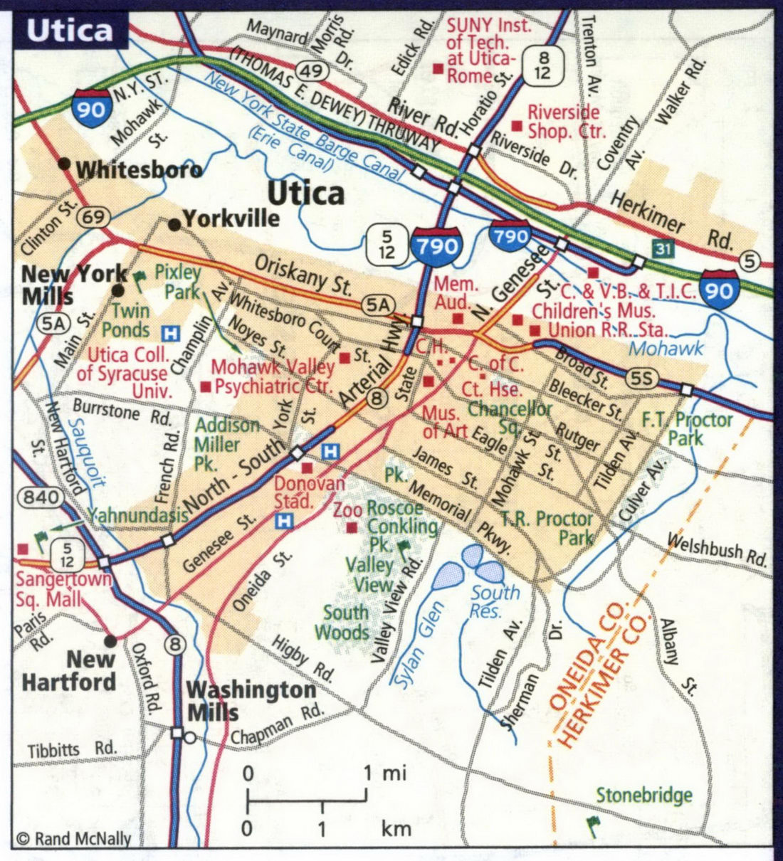
Detailed maps of the cities of Albany, Binghamton, Buffalo, Niagara Falls, Elmira, Manhattan, New York City, Rochester, Syracuse, and Utica NY
Maps of all major cities in New York: Albany, Binghamton, Buffalo, Niagara Falls, Elmira, Manhattan, New York City, Rochester, Syracuse, and Utica NY
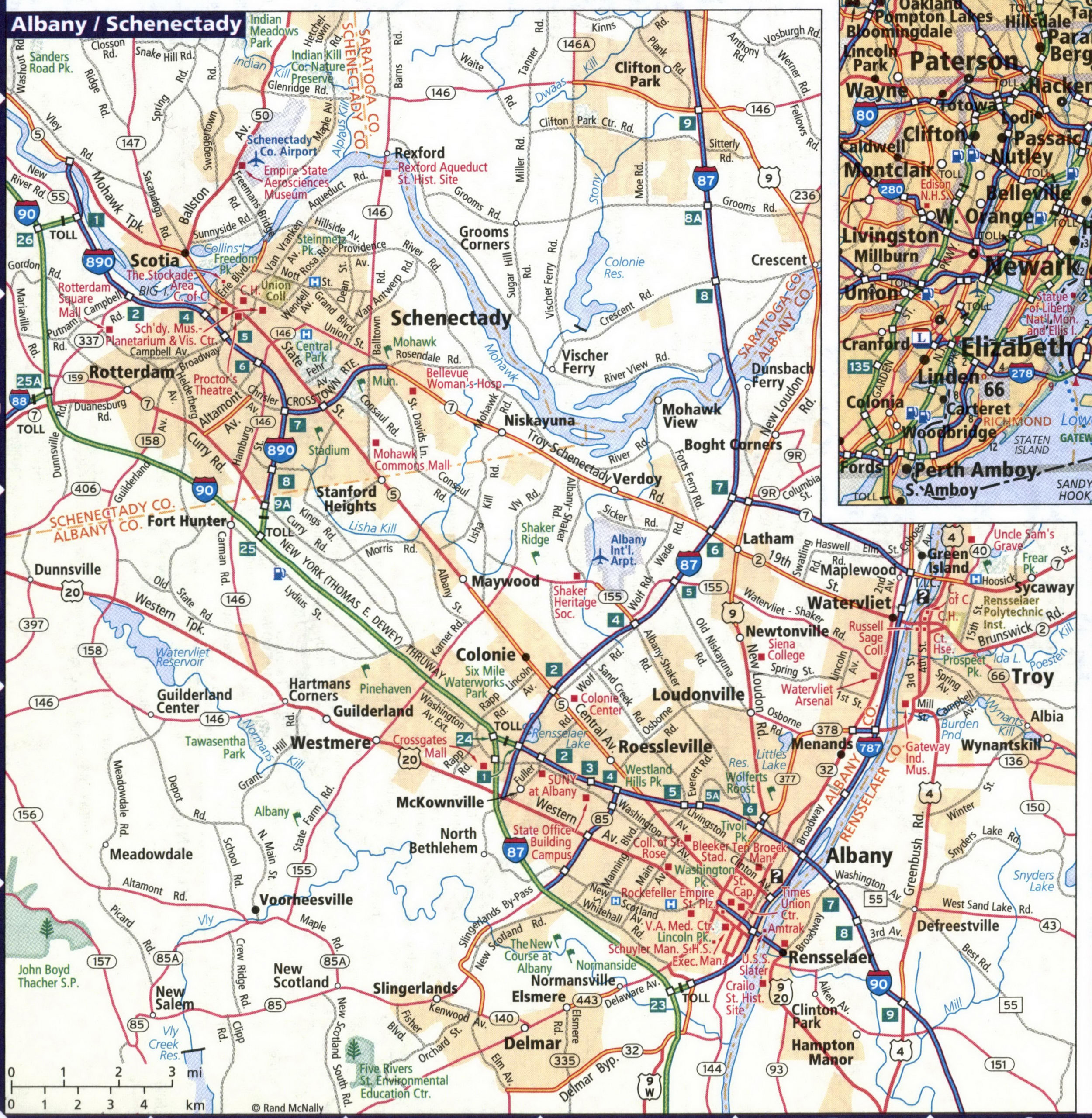
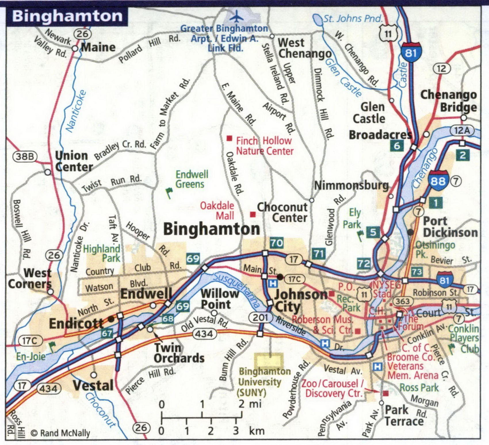
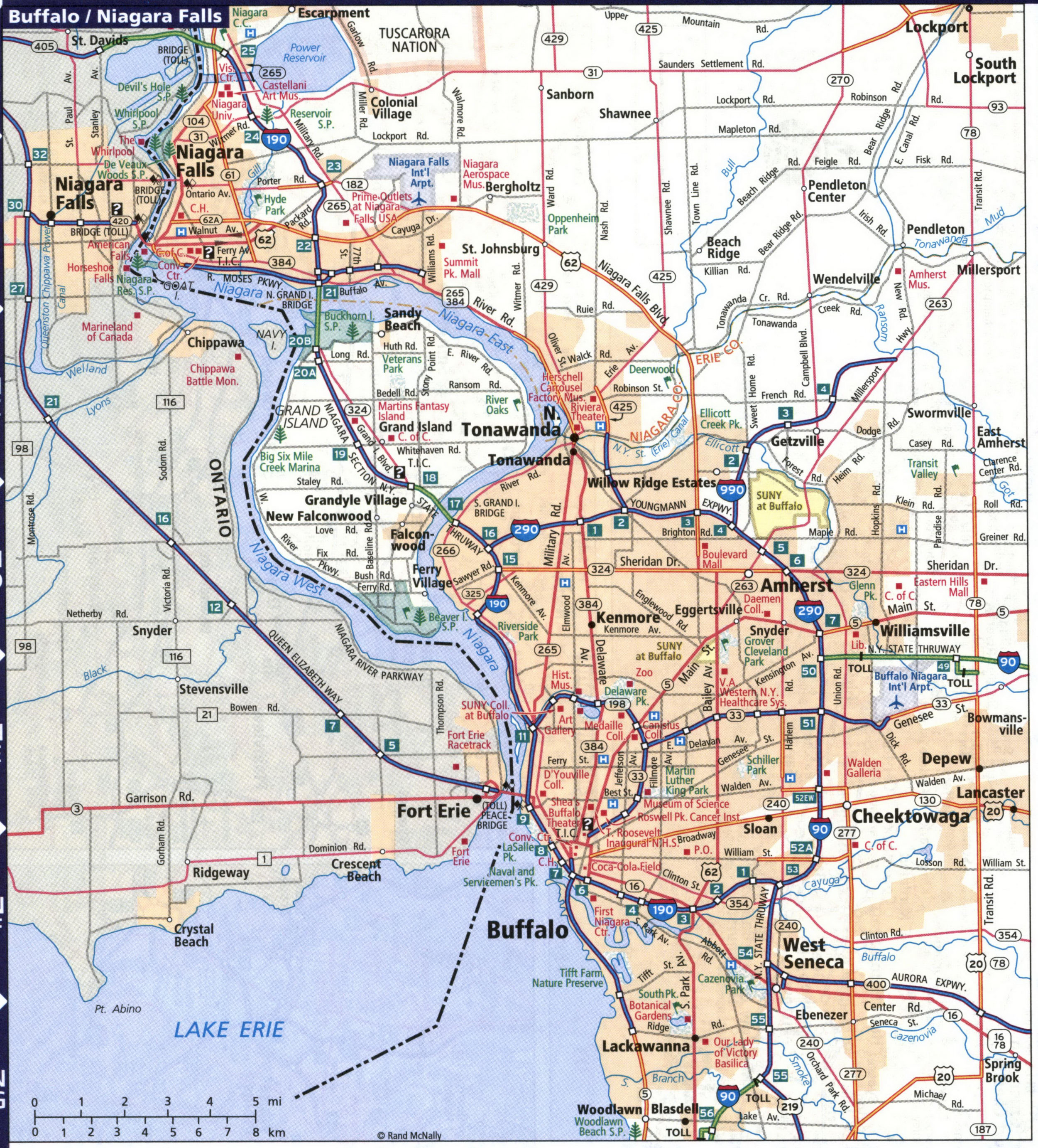
New York's largest cities are Albany, Binghamton, Buffalo, Niagara Falls, Elmira, Manhattan, New York City, Rochester, Syracuse, and Utica NY. Maps of the roadways of these cities are shown here. Cities are arranged in alphabetical order. You can print maps of New York state cities. All images are printable.
Detailed map of streets and highways of the city of Albany and Schenectady.
Detailed map of streets and highways of the city of Binghamton.
Detailed map of streets and highways of the city of Buffalo.
Detailed map of streets and highways of the city of Elmira.

Detailed map of streets and highways of the city of Manhattan.
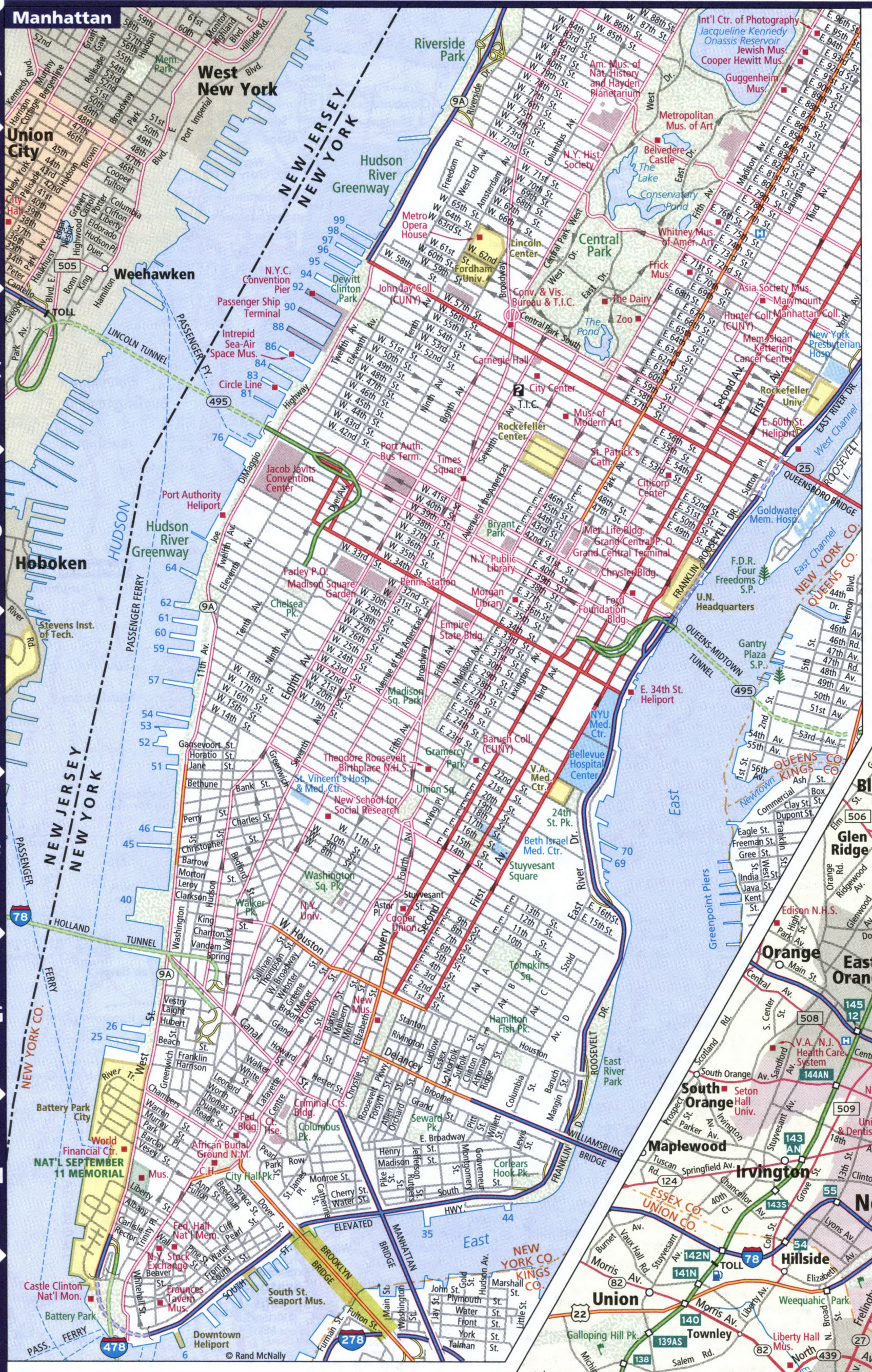
Detailed map of streets and highways of the city of Rochester.
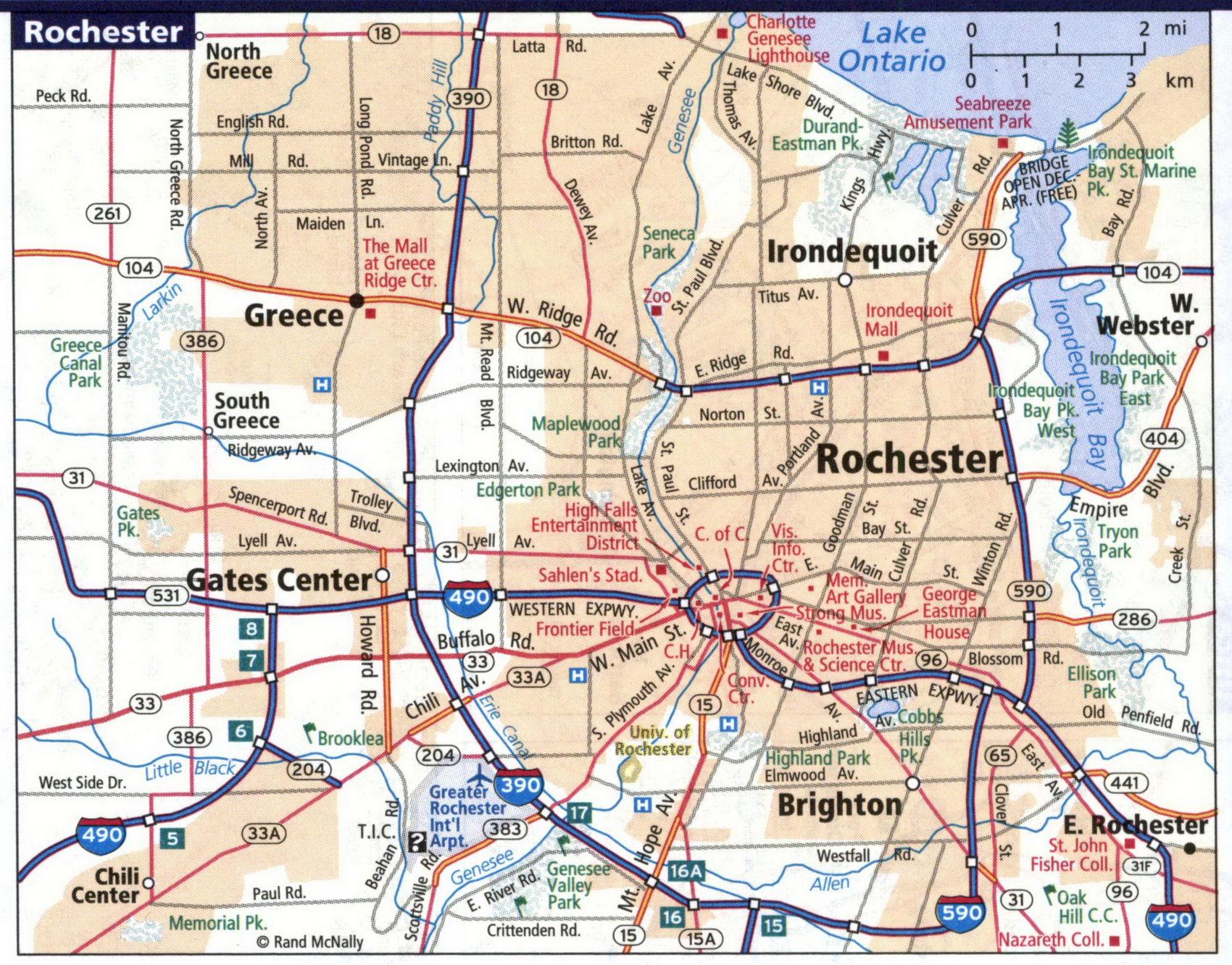
Detailed map of streets and highways of the city of Syracuse.
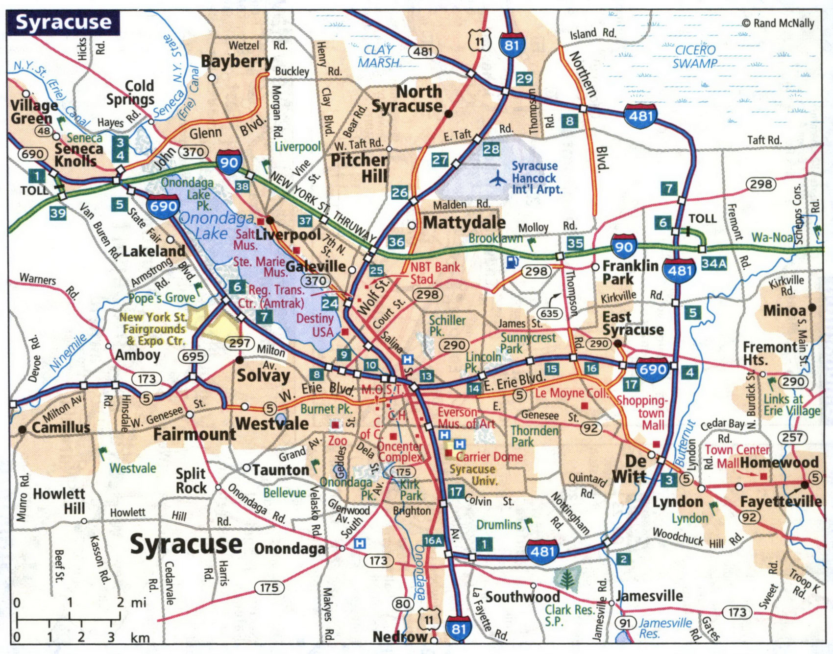
Detailed map of streets and highways of the city of Utica.
