Detailed maps of the cities of Colorado Springs, Denver, and Pueblo CO
Maps of all major cities in Arizona: Colorado Springs, Denver, and Pueblo
Colorado's largest cities are Colorado Springs, Denver, and Pueblo. Maps of the roadways of these cities are shown here. Cities are arranged in alphabetical order. All images are printable.
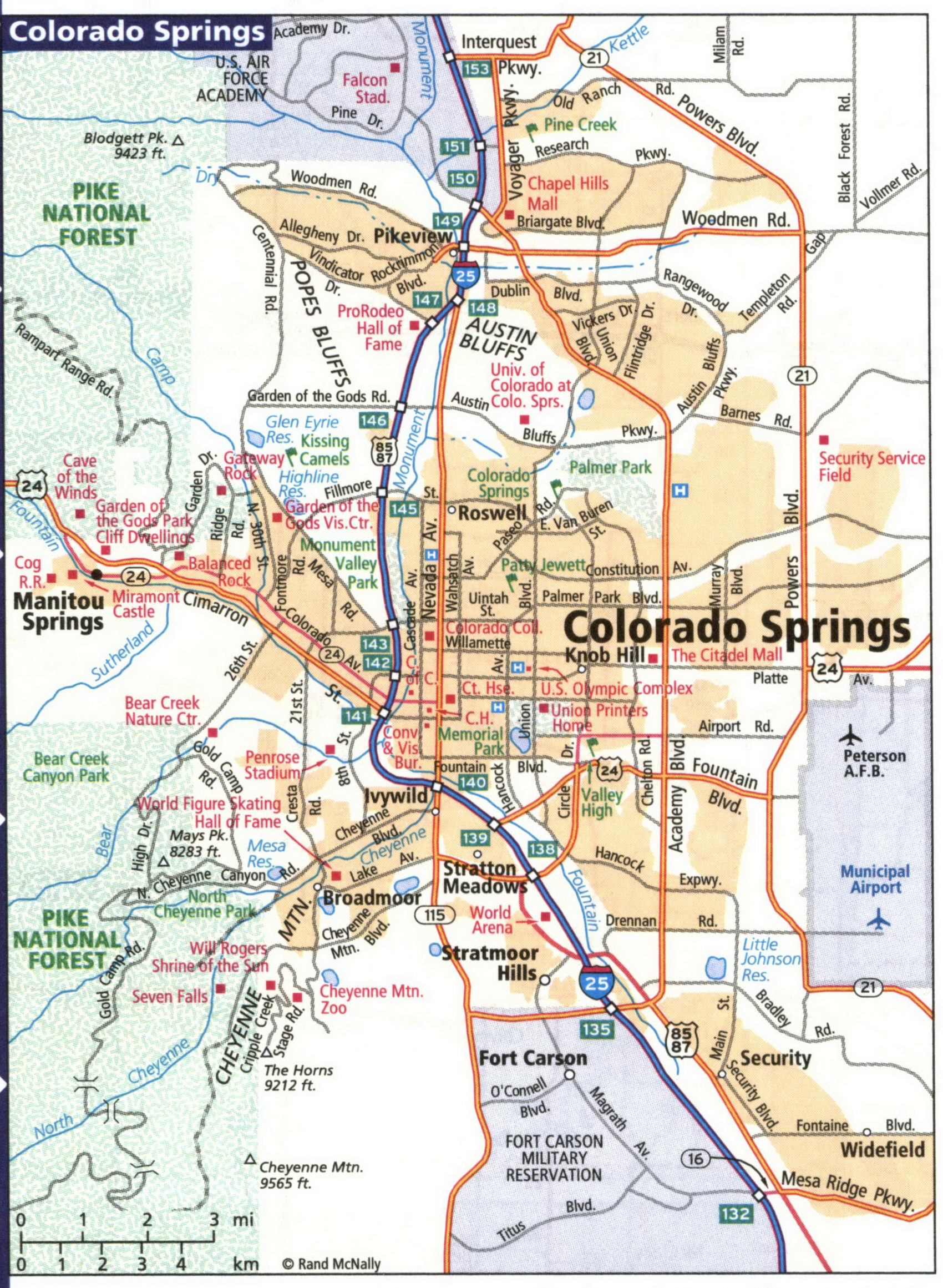
A map of highways and local roads in the city of Colorado Springs

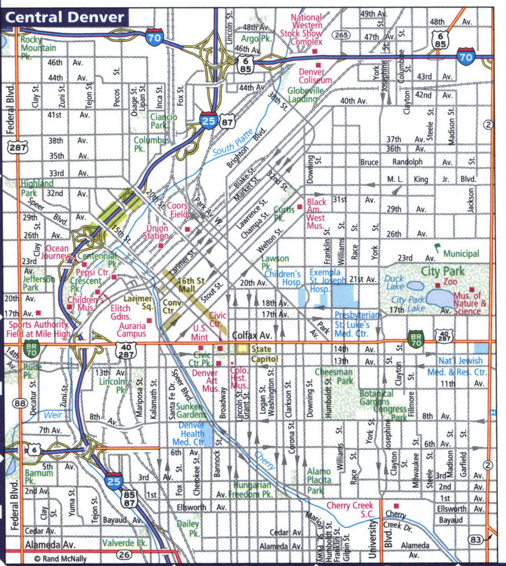
A map of highways and local roads in the city of Denver. Map of Central Denver

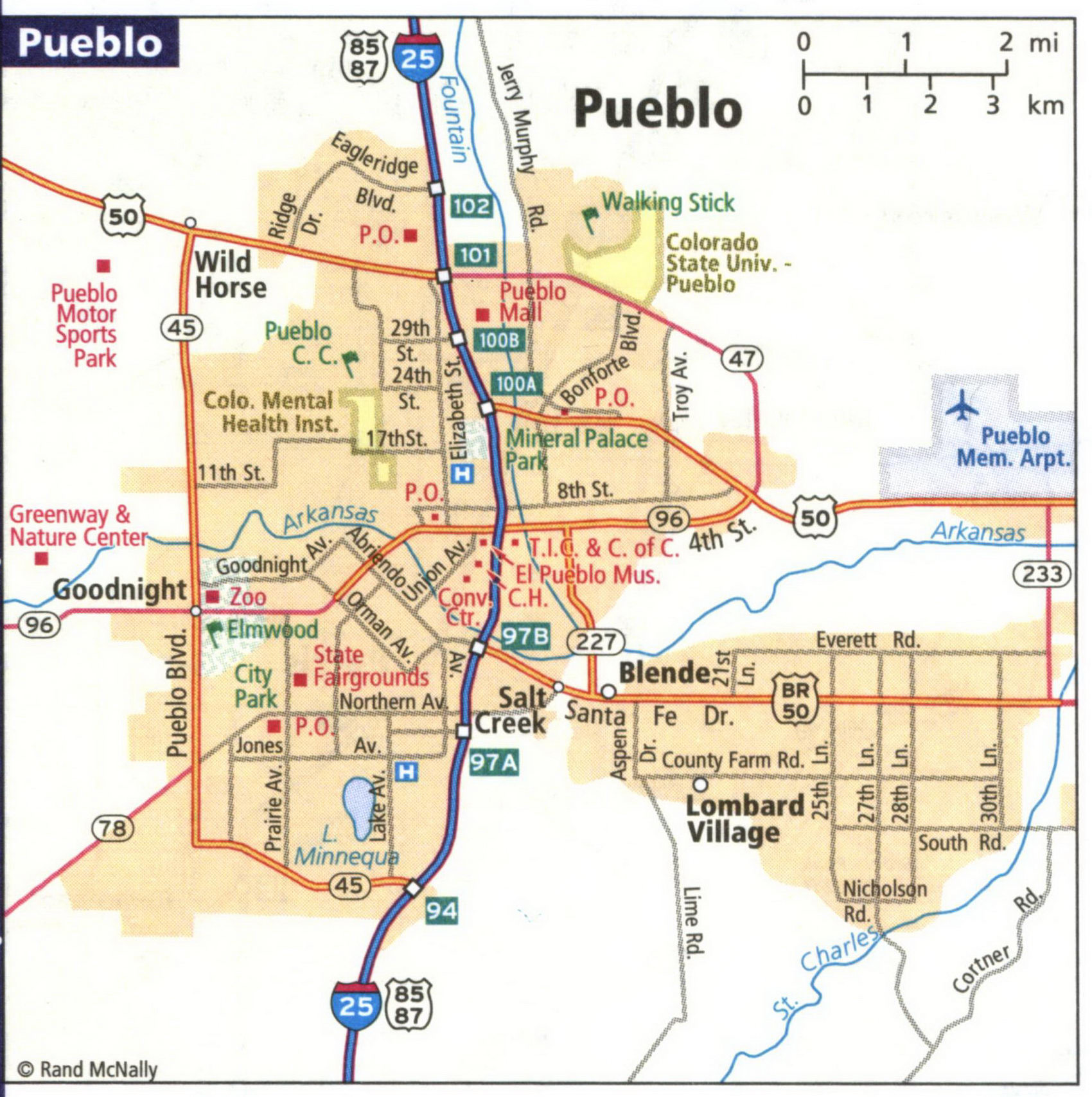
A map of highways and local roads in the city of Pueblo
