Maps of the United States of America - the leader of the global Western world
Detailed maps of the U.S. with cities and towns, parks and other points of interest
Detailed maps of the U.S. with states, cities and towns, parks, recreation areas, and other points of interest.
Particular attention is paid to large-scale maps of highways and highways of all states indicating the distances between markers and highway exit numbers. In addition to the North American countries of the United States and Canada, our atlas contains maps of the countries of the allies in the Global West. First of all, these are the countries of the European Union and the UK. All images are printable. You can print maps of countries and cities. The large map of the United States consists of two parts – the Atlantic Coast and the Pacific Coast.


Distance chart main roads of the USA, Canada, Mexico.
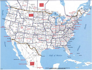
Map of the main roads of the United States. A map of U.S. roads in two fragments - the East Coast and the West Coast.


Detailed map of Canada with provinces and cities. Printable map of Canada. Canada's large road map consists of two parts – the East Atlantic Coast and the Western Pacific Coast of Canada.

